
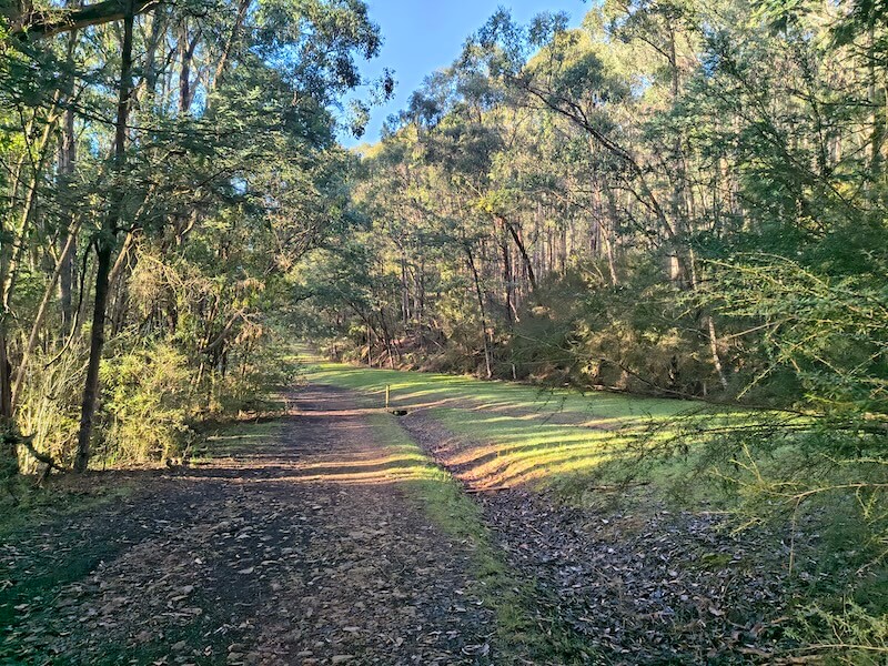
Olinda Creek Walking Track is a point-to-point bushwalk between Silvan Reservoir Park and Mount Evelyn Recreation Reserve. It follows old water infrastructure through dry forest and fern gullies, with a narrower section beside the creek and a small footbridge crossing.
This is a forest walk rather than a waterfall or lookout hike. The appeal is the change in vegetation, the quieter sections around the creek and the contrast between the broad management tracks and the damp gully near the bridge.
Olinda Creek Walking Track at a glance
- Route: Silvan Reservoir to Mount Evelyn Recreation Reserve.
- Distance: published figures range from 4.6km to 5.6km one way, depending on the trailhead used.
- Time: allow about 1.5 to 2 hours one way.
- Grade: Grade 3, with mostly firm dirt or gravel, some narrow and muddy sections, short steep slopes and a creek crossing.
- Best direction: Silvan to Mount Evelyn puts the steep hill near Mount Evelyn on the descent.
- Format: linear, not a loop. Use two cars or return the same way.
- Toilets: Mount Evelyn Recreation Reserve and Silvan Reservoir Park.
- Dogs: not permitted through the national park section.
Which direction should you walk?
Silvan to Mount Evelyn is the easier direction for most walkers. The route undulates, but the noticeably steep hill near Mount Evelyn becomes a descent near the end. Starting at Mount Evelyn means tackling that hill early.
The Silvan trailhead is the overflow parking area on Stonyford Road, almost opposite an entrance to Silvan Reservoir Park. At the other end, use Mount Evelyn Recreation Reserve on Tramway Road.
If you only have one car, start at Mount Evelyn and walk as far as you like before returning. The full out-and-back is roughly 9.2km to 11.2km, depending on which published endpoints you follow.
Walking from Silvan to Mount Evelyn
From the Silvan overflow parking area, take the track signed towards Mount Evelyn and follow it towards the water-treatment infrastructure. At the fence line, Grey Gum Track branches along the fence. Continue on Grey Gum Track until Olinda Creek Track turns off to the left.
This is where the route becomes narrower and more interesting underfoot. Steps lead down towards Olinda Creek, followed by a small footbridge. The ground around the creek can be muddy, especially after rain.
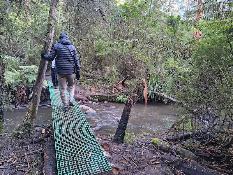
After the bridge, the path soon meets a wider section of Olinda Creek Track. Follow the Mount Evelyn signs from here. The track passes through fern gullies and more open forest, crossing parts of the old Mount Evelyn aqueduct alignment.
The final approach to Mount Evelyn runs down an open, fairly steep hill. At the bottom, turn right onto the smaller track leading into Mount Evelyn Recreation Reserve. Continuing ahead instead brings you out near York Road.
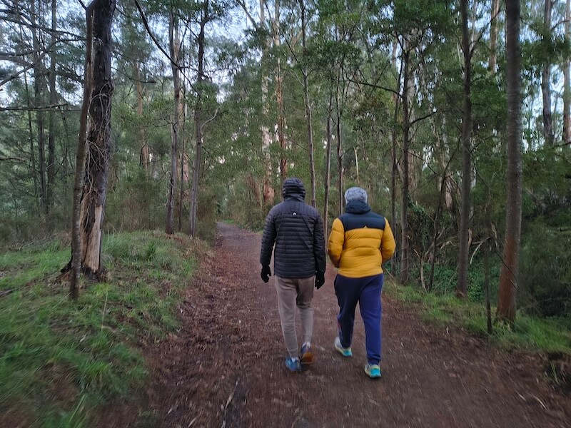
The junctions near Silvan matter more than the middle of the walk. Carry the Parks Victoria Olinda-area map, particularly if you plan to add Grey Gum Track or another forest route.
How long is Olinda Creek Walking Track?
The published distances are inconsistent. An older Parks Victoria track note describes the full Silvan-to-Mount Evelyn route as 5.6km and about two hours one way. A detailed local route guide measures 4.6km from the Stonyford Road overflow parking area and allows 1 to 1.5 hours each way. Visit Yarra Valley also uses 4.6km.
The difference appears to come from the trailheads and connecting tracks included in each measurement. For planning, allow 4.6km to 5.6km one way and up to two hours. A return walk is approximately 9.2km to 11.2km.
See the Visit Yarra Valley track description and the Silvan-to-Mount Evelyn route notes for the two commonly quoted versions.
Track surface and difficulty
Most of the walk uses firm dirt, gravel or broad management track. The Olinda Creek section is narrower, with roots, damp ground and a short descent to the footbridge. There are also undulations through the forest and the steeper slope at the Mount Evelyn end.
Grade 3 is a reasonable description. The track is manageable for regular walkers, but it is not a flat shared path. The narrow creek section, steps, mud and steep hill make it unsuitable for prams, road wheelchairs and small-wheeled scooters.
What you will see along the way
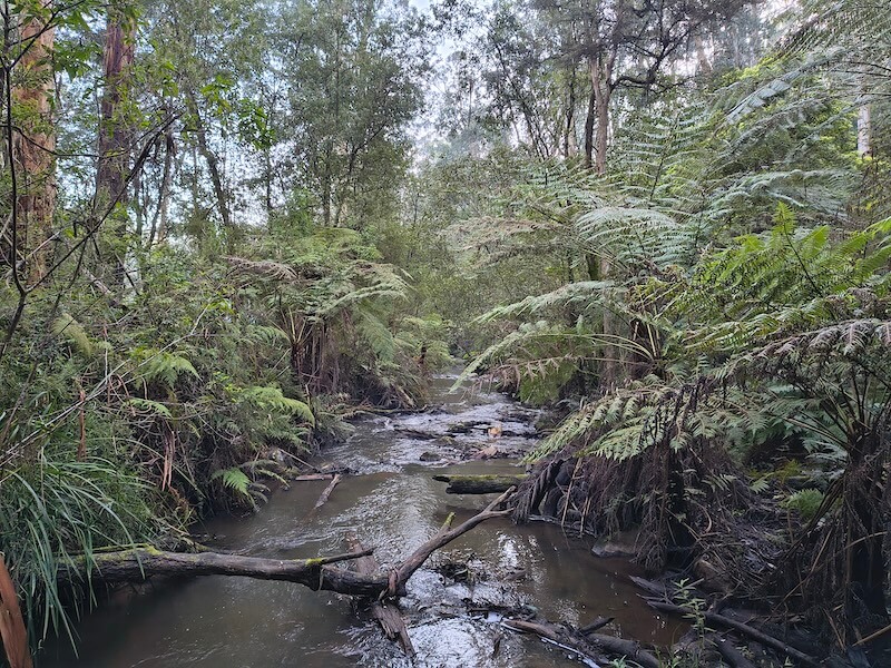
The vegetation is the main feature. Higher, rockier ground carries drier open forest, while the creek gullies are greener and filled with ferns. Messmate and mountain ash rise above parts of the route, and wet weather brings out fungi and deepens the green around Olinda Creek.
Near Mount Evelyn, silver valves beside Pipe Track Road connect to an underground pipeline carrying water from Silvan Reservoir towards Preston. Parts of the walk also cross the alignment of the old Mount Evelyn aqueduct.
Parks Victoria lists echidnas, wombats, wallabies, wedge-tailed eagles and crimson rosellas around Silvan Reservoir Park. Older track notes also mention superb lyrebirds and black wallabies. They are not guaranteed sightings, but the bridge and quieter creek sections are good places to pause and listen for birds.
Parking, toilets and the return trip
Silvan: the most convenient walking trailhead is the overflow parking area on Stonyford Road, opposite Silvan Reservoir Park. Inside the reservoir park, Parks Victoria lists about 45 spaces at the upper car park and about 50 at the lower car park. Toilets, picnic shelters and the playground are near the lower car park.
Silvan Reservoir Park is open daily from 9am to 4pm and closes on days of Extreme Fire Danger or severe weather. The overflow trailhead is separate from the picnic-area parking, but anyone using the park facilities or leaving a car inside must account for the gate time.
Mount Evelyn: Mount Evelyn Recreation Reserve is at 45 Tramway Road. It has public toilets, a playground and open space beside the sports oval.
One-way walk: leave one car at Mount Evelyn Recreation Reserve and take the other to the Silvan overflow parking area. Public transport is most useful at the Mount Evelyn end. Route 663 runs between Belgrave and Lilydale via Monbulk and Mount Evelyn; see the current Route 663 timetable and stops.
Can you bring a dog?
No, not on the full route. Some older local guides call this a dog-friendly walk because dogs on lead are allowed in Silvan Reservoir Park and around Mount Evelyn. However, the track passes through Dandenong Ranges National Park, where Parks Victoria does not allow dogs. The current national park rule takes priority over older route descriptions.
When to walk and current conditions
The creek and fern gullies look their best after rain, but that is also when the narrow section becomes muddy and slippery. After a dry spell, the route is firmer and easier underfoot.
Current access note, updated August 2026: selected parts of Dandenong Ranges National Park are closing at night for deer control operations between 16 August and 19 November 2026. Affected areas close from 4pm to 7am on selected nights. Check the live park conditions and closures before visiting.
Do not confuse it with the lower Olinda Creek Trail
The similarly named Olinda Creek Trail is beside Swansea Road near Lilydale. Council lists 1.7km of gravel and dirt, plus a separate 1.8km sealed Swansea Road shared path. Choose that lower route, or the 2.5km circuit at Lillydale Lake, if you want a shorter and less demanding walk.
The water story behind the walk
Silvan Reservoir was completed in 1932. Parks Victoria says its 40-billion-litre capacity increased Melbourne’s water storage by 75 per cent at the time. The valves, fenced water infrastructure and old aqueduct alignment are reminders that this forest corridor is still connected to Melbourne’s water supply.
Olinda Creek is part of the traditional Country of the Wurundjeri People. Yarra Ranges Council’s Walk Birrarung shares Wurundjeri Senior Elder Doreen Garvey-Wandin’s account of water and Country, along with the history of Olinda Creek in Lilydale.
Olinda Creek Walking Track FAQs
Is the walk a loop?
No. It is a linear route between Silvan and Mount Evelyn. Walk one way with a car shuffle or return along the same track.
Which end is easier to start from?
Starting at Silvan puts the steep Mount Evelyn hill on the descent. Starting at Mount Evelyn gives you the easier public-transport connection but begins with a steep climb.
Is the track suitable for bikes?
The narrow creek section is a walking route. Cyclists should use Parks Victoria’s nearby 13km Silvan mountain-bike network or the lower shared paths.
Is Olinda Falls part of this walk?
No. Olinda Falls is higher in Dandenong Ranges National Park and has a separate road approach and trailhead.