

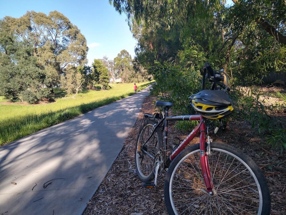
If you have ever searched for somewhere in Melbourne where you can walk, ride or run without constantly stopping at traffic lights, the Dandenong Creek Trail is worth knowing about.
The shared path follows Dandenong Creek through Melbourne's eastern and south-eastern suburbs, linking local parks, wetlands, playgrounds and several other trails. You can use it for a short walk after work, a family bike ride around Jells Park, a Saturday morning parkrun or a much longer ride towards Carrum.
That flexibility is what makes the trail useful. Most people are not trying to complete the entire route. They join near home, travel as far as they feel like going and turn around when they have had enough.
On a Saturday morning around Jells Park, that might mean parents helping children find their balance on a bike, runners moving through a longer training session, people walking dogs and friends catching up over a slow lap. They are all using the same path, but not for the same reason.
Where does the Dandenong Creek Trail start and finish?
The northern end begins near Chandlers Lane in Kilsyth South. From there, the trail follows the creek through areas including Bayswater, Heathmont, Wantirna, Vermont South, Glen Waverley, Wheelers Hill, Mulgrave and Dandenong before continuing towards Carrum and the Patterson River.
You will see different distances quoted online. The City of Maroondah and the City of Monash describe the trail as approximately 44 kilometres, while some broader route descriptions place it closer to 49 kilometres.
The difference usually comes down to the exact points used as the beginning and end, and whether connecting sections are included. For a casual visit, the number matters less than choosing a section that suits your plans.
Where should a first-time visitor start?
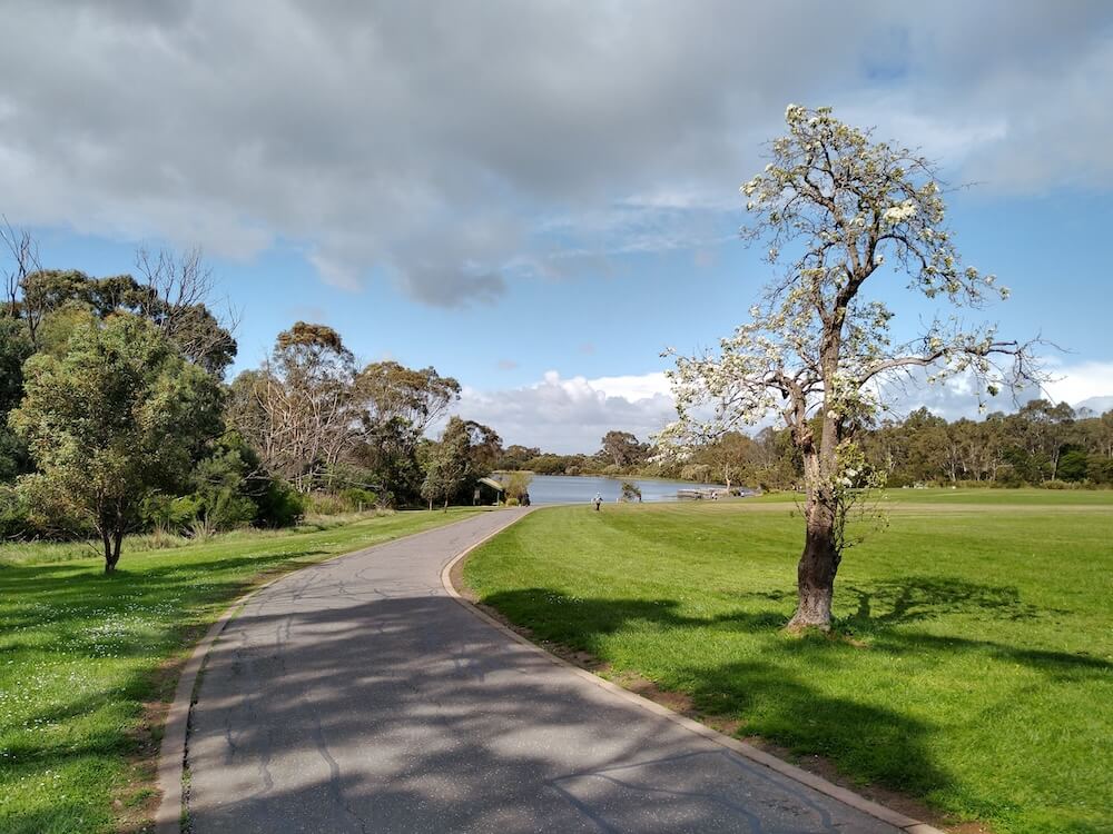
For many people, Jells Park in Wheelers Hill is the simplest introduction. It has parking, toilets, picnic areas, open space and several paths that connect directly with the main trail. There are also shorter loops, so you do not have to commit to a long out-and-back journey.
The park works well for families, beginners and anyone returning to regular movement. You can walk beside the lake, ride through the wider parkland or follow the trail north towards Glen Waverley and south towards Mulgrave.
Parks Victoria's Jells Park guide is the best place to check current facilities, park conditions and visitor information before leaving home.
Which section is best for you?
For a relaxed walk
Start around Jells Park, Tirhatuan Park or one of the larger reserves along the route. These areas give you room to shorten or extend the walk without needing to follow the entire creek corridor.
For children learning to ride
Choose a wide, open section near a major park and visit outside the busiest weekend periods. The trail is shared by walkers, runners, scooters and faster cyclists, so children should keep left and stay close to an adult.
For a longer bike ride
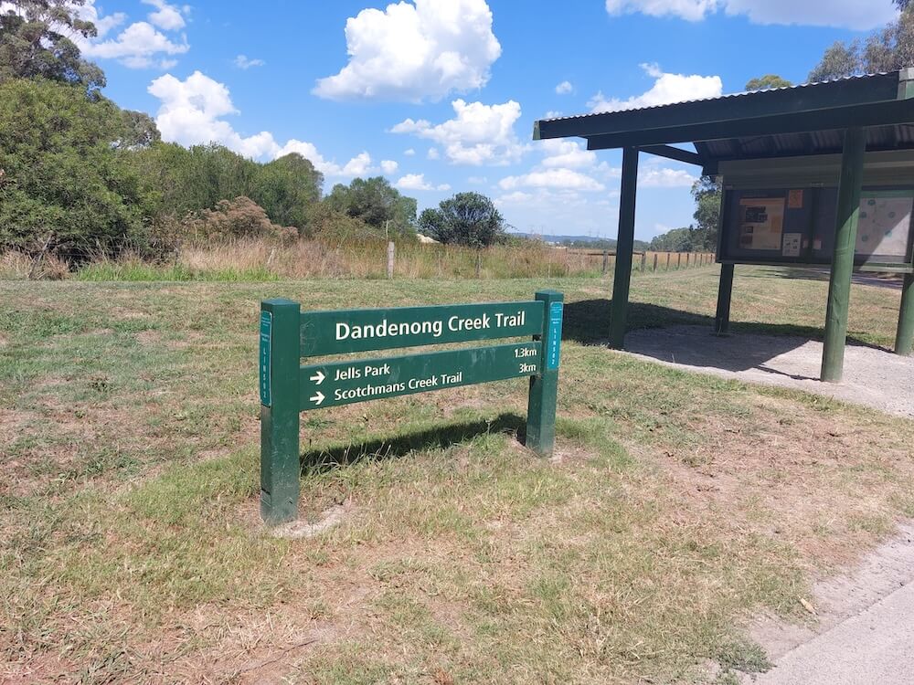
The trail becomes much more interesting when you use its connections. Near Jells Park it links with the Scotchmans Creek Trail, while other junctions connect with the EastLink, Blind Creek, Tarralla Creek and Hallam Bypass trails.
These links make it possible to build longer rides across Melbourne's east. They can also make navigation confusing at a few junctions, so it is sensible to check a map before you begin rather than assuming every branch continues beside Dandenong Creek.
For running
The mostly gentle terrain makes many sections suitable for an easy run or a longer steady session. Distance markers are not consistent across the full route, so a phone or GPS watch can help if you are aiming for a particular distance.
Runners returning from injury should get individual advice from a qualified health professional before increasing distance or intensity.
Events and organised runs around the trail
The Dandenong Creek corridor is not only used for everyday exercise. It also supports weekly parkruns and larger community events, giving first-time visitors an easy way to experience parts of the area with other people around.
Jells parkrun
Jells parkrun is a free weekly 5 kilometre community event at Jells Park in Wheelers Hill. Participants can walk, jog, run, volunteer or simply come along to watch.
The course is held on bitumen paths within Jells Park, making it a natural addition to a visit to this section of the Dandenong Creek corridor. It is also a useful option for people who like the idea of running or walking with others but do not want to join a competitive club.
Like other parkruns, it takes place on Saturday mornings. Register once before your first event and check the official event page before travelling in case of a cancellation or course change.
Dandenong parkrun
Dandenong parkrun is another free weekly 5 kilometre event, based at Dandenong Park near Pultney Street.
The City of Greater Dandenong lists it for every Saturday at 8am and describes it as open to runners, joggers, walkers and volunteers of different ages and experience levels. The group also meets for coffee after the event, which makes it as much a regular community gathering as a timed 5 kilometre course.
Dandenong Park is close to the creek corridor and can be a practical starting point for exploring the lower section of the trail before or after the event.
Run Maroondah
Run Maroondah is based at HE Parker Reserve in Heathmont. The 2026 event is scheduled for Sunday 4 October and is designed for individuals, families and friends to take part in physical activity together.
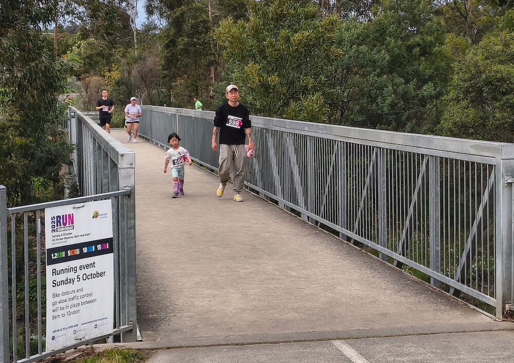
The reserve sits beside the Dandenong Creek corridor, making the event another way to experience the northern part of the trail in an organised setting. Check the council event page for current distances, registration details and any course updates.
Run Maroondah is sometimes confused with the Maroondah Dam Trail Run. They are different events. The dam event takes place at Maroondah Reservoir Park near Healesville rather than on the suburban Dandenong Creek corridor.
Other community activities
Local councils, running groups and community organisations sometimes hold fun runs, walks, clean-up days and social rides along different sections of the creek corridor. Event locations and dates can change, so checking council event pages and organiser websites is more reliable than relying on an old calendar listing, but KeepActive's running events listing is a good place to check what's coming up nearby.
The Dandenong Creek Art Trail
There is more to notice than the creek and surrounding parkland. Between Heathmont and Dandenong, the Dandenong Creek Art Trail includes seven public artworks created with Traditional Owners and Aboriginal and Torres Strait Islander artists across six council areas.
The works connect stories with the places where they are experienced. Someone travelling quickly may pass without noticing them, while a slower walk gives you more time to see how the artworks sit within the surrounding landscape.
RMIT's account of the project explains how researchers and artists worked together, and why Indigenous cultural protocols need to reflect the particular community and Country involved rather than following one generic process.
"Sometimes the best learnings come from experience, and so to see an artist's interpretation of a story, on the land where the story takes place, can have a great effect on you."
Dr Marnie Badham, RMIT University
The trail follows a much older landscape
It is easy to think of the Dandenong Creek Trail as a modern path connecting Melbourne's suburbs. The creek corridor has a much longer story.
Waterways, wetlands and the former Carrum Swamp shaped how people moved through and lived across this country for thousands of years. Historical material published by the City of Greater Dandenong describes the floodplain, wetlands and elevated ground along Dandenong Creek as important places for Aboriginal life before European settlement.
The trail crosses Country associated with more than one Traditional Owner group. Council and park acknowledgements vary along the route because the creek extends across a large part of Melbourne. Visitors should pay attention to the acknowledgements and interpretive material provided at each location rather than treating the whole corridor as one culturally uniform place.
The City of Greater Dandenong's historical narrative provides useful background on the relationship between water, wetlands and First Nations occupation in the lower Dandenong area. The public artworks installed along the creek provide another way to learn about Country through the work of Traditional Owners and Aboriginal and Torres Strait Islander artists.
From paddocks and drains to a connected green corridor
The landscape beside the trail has changed repeatedly. Sections that now feel like continuous parkland have previously been farmland, grazing paddocks, industrial land, engineered drains and flood-management infrastructure.
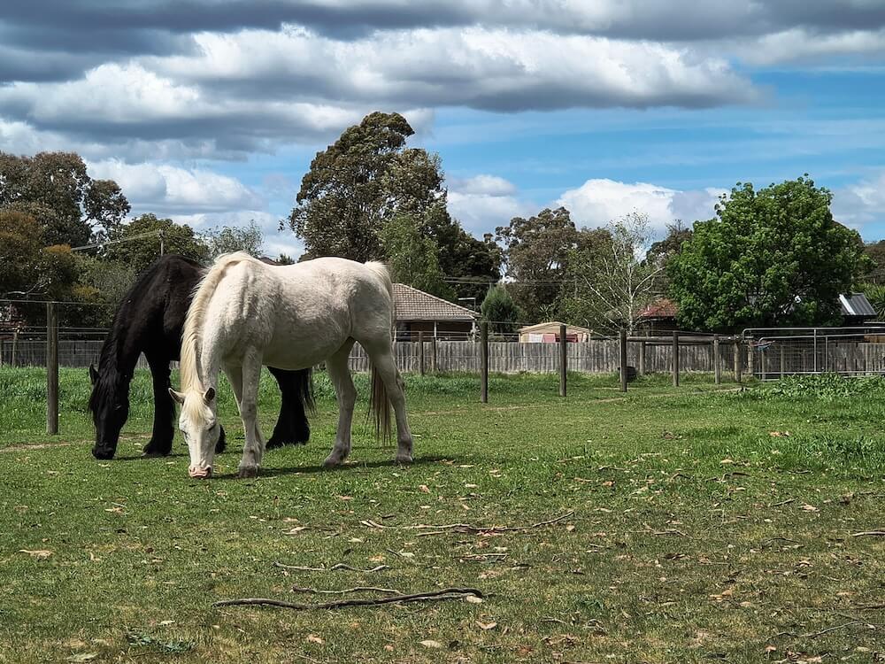
The trail and surrounding reserves did not appear as one finished project. Paths, wetlands, bridges, plantings and park connections were added over many years by councils, water authorities, Parks Victoria and local community groups.
That work is still continuing. Melbourne Water's Better Environment Plan for Dandenong Creek focuses on reducing pollution, improving habitat for native fish and responding to wet-weather sewage overflows. Its earlier Enhancing Our Dandenong Creek program brought together councils, businesses, community groups and government agencies.
The wider Living Links partnership, established in 2006, works across the Dandenong Creek catchment to connect natural spaces, restore habitat, manage weeds and pest animals, and help communities engage with the landscape.
This history explains why the trail changes character so often. One section may pass through planted wetlands and bird habitat. A few kilometres later, it may run beside sports grounds, industrial areas or remnants of an older rural landscape.
Rocky's Reserve: the horse remembered by a neighbourhood
Some of the most memorable stories along the corridor are not grand historical events. They are small pieces of neighbourhood memory.
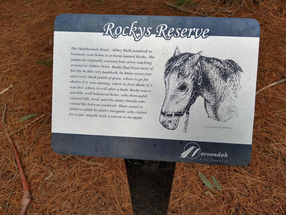
Rocky's Reserve, near Heatherdale Road and Abbey Walk in Vermont, is named after a horse that once lived in a paddock on the site. An interpretive sign installed by Maroondah City Council says the paddock originally covered about four acres and extended towards Shibor Drive.
Rocky spent most of his life there. According to the sign, he knew the trees, thick patches of grass and the best places to find shelter, shade or somewhere to roll after a bath. Local adults and children regularly visited him for a pat, often bringing a carrot or an apple.
The paddock eventually disappeared as the surrounding suburb changed, but the reserve preserved the horse's name and the story local people associated with the land. It is the sort of place someone could pass on a bike without noticing. Stopping to read the sign turns an ordinary patch of open space into a reminder that suburban landscapes carry personal histories as well as official ones.
Rocky's Reserve also gives families an easy reason to slow down. Children who are not interested in trail distances or creek engineering may remember the story of the horse long after the ride itself.
Jells Park also grew from a changing valley
Jells Park now feels like an established part of Melbourne, but its open lawns, lake, conservation areas and recreation paths are part of the broader transformation of the Dandenong Creek Valley into connected public parkland.
Parks Victoria describes Jells Park as part of a network of parks beside Dandenong Creek. The park now covers 127 hectares and includes more than nine kilometres of paths and trails, but its importance is not only its size. It provides a place where the larger creek corridor becomes easy to access for families, walkers, runners and cyclists.
From Jells Park, riders can follow the trail through Bushy Park wetlands and Koomba Park or continue towards other parts of the Parks Victoria estate. This connection between recreation and habitat is one of the defining features of the middle section of the trail.
What is the trail surface like?
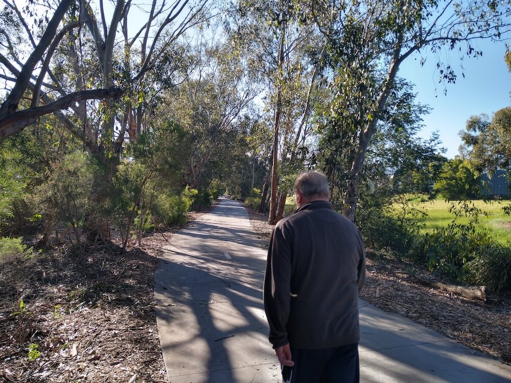
The route includes sealed and unsealed sections. Conditions vary between council areas, and surfaces can become wet, slippery or muddy after rain.
The trail is generally easier than a technical bush trail, but that does not mean every part feels identical. Some sections pass through broad parkland, while others follow narrower creek corridors or travel near roads and urban infrastructure.
People using mobility aids, wheelchairs, prams or small children's bikes should check the specific section before visiting. Major parks usually provide the most predictable starting point.
Can you reach the trail by public transport?
Several railway stations provide access to parts of the corridor, although the walking distance varies. Bayswater and Dandenong are among the more practical options for joining the route, while Carrum provides access near the southern end.
Glen Waverley Station can be useful for reaching connecting paths, but Jells Park itself is not directly beside the station. Check the complete walking or cycling route before assuming a station is only a few minutes from your chosen starting point.
Bikes can be taken on metropolitan trains, but busy services may have limited room. Avoid blocking doors and allow extra time if you are travelling with several riders.
Parking, toilets and water
Facilities are concentrated around major parks rather than evenly spaced across the entire route. Jells Park, HE Parker Reserve, Tirhatuan Park and Dandenong Park are useful places to investigate when planning a start point.
Do not assume that every reserve has working toilets, drinking water or an open cafe. Check the relevant council or Parks Victoria page before a longer trip, particularly early in the morning or on a public holiday.
Is the Dandenong Creek Trail dog-friendly?
Dogs can be taken through many parks and reserves along the corridor, but on-lead and off-lead rules differ between council areas and can change within the same park.
Follow signs at your location, carry a lead and keep your dog under effective control around cyclists, children and wildlife. The shared trail itself can become busy, so even confident dogs may be safer on lead near narrow sections and intersections.
Is the trail lit at night?
Lighting is inconsistent. A well-used section near a park, station or town centre may feel very different from a quieter connector after dark.
For an evening walk or run, choose a familiar section, carry a light and tell someone where you are going. Reflective clothing is also helpful on a shared path where cyclists may approach from behind.
Tips for a safer and easier visit
- Keep left and move predictably on the shared path.
- Use a bell or friendly voice before passing.
- Slow down around children, dogs and busy park entrances.
- Check weather and council alerts after heavy rain.
- Download or save a map before trying unfamiliar junctions.
- Carry water on longer sections because fountains are not evenly spaced.
- Use lights and reflective gear in low light.
Finding someone to walk, ride or run with
You do not need a group to use the trail, but company can make a longer route feel easier and help with navigation on your first visit.
KeepActive lists walking groups around Melbourne and local cycling groups. You can also browse running groups near the suburb where you plan to join the trail.
You do not need to finish the whole trail
A long trail can sound like something reserved for serious cyclists or distance runners. In practice, the Dandenong Creek Trail is just as useful for a 20-minute walk, a child's first longer bike ride or a relaxed Sunday morning with no target distance.
Pick a convenient starting point. Decide roughly how long you want to be out. Then turn around before the trip stops being enjoyable.
The value of a trail like this is not that you can say you completed every kilometre. It is that so many people across Melbourne's east have a place nearby where getting outside can be simple.